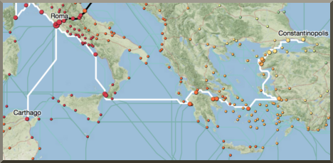
Spanning one-ninth of the earth's circumference across three continents, the Roman Empire ruled a quarter of humanity through complex networks of political power, military domination and economic exchange. These extensive connections were sustained by premodern transportation and communication technologies that relied on energy generated by human and animal bodies, winds, and currents.
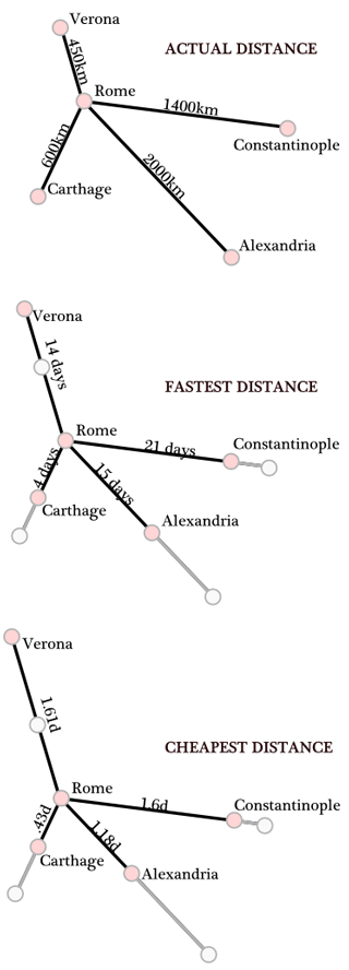
Conventional maps that represent this world as it appears from space signally fail to capture the severe environmental constraints that governed the flows of people, goods and information. Cost, rather than distance, is the principal determinant of connectivity.
For the first time, ORBIS allows us to express Roman communication costs in terms of both time and expense. By simulating movement along the principal routes of the Roman road network, the main navigable rivers, and hundreds of sea routes in the Mediterranean, Black Sea and coastal Atlantic, this interactive model reconstructs the duration and financial cost of travel in antiquity.
Taking account of seasonal variation and accommodating a wide range of modes and means of transport, ORBIS reveals the true shape of the Roman world and provides a unique resource for our understanding of premodern history.
Introducing ORBIS |
Understanding ORBIS |
Building ORBIS |
Using ORBIS |
Mapping ORBIS |
Applying ORBIS |
What is ORBIS, and what does it do? Start with this short introduction to learn more about our project. |
What can you expect of ORBIS? Discussion of three key features will help you appreciate the capabilities and limits of our model. |
How was ORBIS designed and what is the basis of the model? This section describes the historical data and information technology that guide our simulations. |
What do you need to know to make the most of ORBIS? This brief manual explains how to generate simulations and achieve the best results. A video tutorial is also available. |
The network map of the Roman Empire is the centerpiece of this site. After familiarizing yourself with the model's structure and functionality, use the map to explore the ancient world. |
ORBIS has been created to foster new ways of studying the ancient world. This section presents scholarship supported by our model. |
| How to cite ORBIS |
|
|
| Website problem? Let us know | Follow @orbis_stanford | |


 Due to an unexpectedly high volume of traffic to the site, performance of the routing map and interactive cartogram are not what they should be. If you experience delays performing route calculations or rendering the map, you can try refreshing the map by zooming in or out. Please do return next week -- these issues should be entirely solved by then. We are very sorry for any inconvenience!